
Each month of 2019, I’d followed through with my goal and ran in a new-to-me location. But I’d gotten to Christmas Day without running somewhere new in December.
I’d been at my aunt and uncle’s house the evening of Christmas and stayed over before heading back to Salisbury the next morning. I was talking to them about how I planned to run somewhere on the way back from their house, and my uncle suggested a trail off Route 29. One of them mentioned that it was really rocky at the beginning, and my aunt said I would see two brick buildings on either side of the road.
The parks are Burnt Mills East Special Park and Burnt Mills West Special Park. I decided to visit the one they’d gone to, on the left side of the road from where I was heading — Burnt Mills East Special Park.
I passed it the first time around, and the parking lot was empty aside from some construction equipment and employees.
I checked out the map on a kiosk and decided to go to the right, toward the rocks. This map that I found online (page 3) seems to most clearly outline where I ran: I went on the Fall Line Trail, then the Rachel Carson Greenway Trail, and then the Northwest Branch Trail.
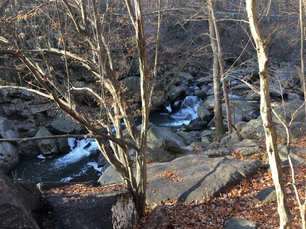
The first part of the trail was so rocky that it took me about eight minutes to go a little more than 0.2 miles. I did also stop for photos, but even without the photos, I think it would have taken at least five minutes to climb between the rocks.

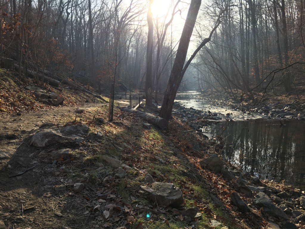
After that, I followed a dirt trail along the Northwest Branch of the Anacostia River. The trail later became a single track trail with lots of ups and downs. I decided to run two miles out and two miles back, and by the time I got to about 1.75 miles out, the trail became a paved trail. Judging by the map I linked to above, this appears to be where the trail became the Northwest Branch Trail.
Once I hit two miles on my watch, I turned around and headed back the way I came. There were other offshoots of the trail, too, some of which I think were connectors to neighborhoods. Right before I entered the rocky area to get back to my car, I saw a swing with a thick wooden branch to sit on, which I hadn’t noticed on my way out. I sat there and swung just a little (because I wanted to make sure I didn’t break it) before heading back.

In just two miles one-way, I got to experience various terrains, and I enjoyed this run/hike. I wouldn’t recommend heading here for a fast run, but it’s definitely a fun one.
The trail is located at 10701 Columbia Pike in Silver Spring. I hope to get a chance to check out the trails in Burnt Mills West Special Park, sometime, too!

I set a goal to travel to at least one new-to-me place for a run each month of 2019. Here are the other places I’ve traveled to for runs this year:
- November: Wye Island Natural Resources Management Area
- October: York County Heritage Rail Trail
- September: Red Run Stream Valley Trail, Richmond Region
- August: New Smyrna Beach, Florida
- July: Tuckahoe State Park, Delaware & Raritan Canal State Park and Delaware Canal State Park trails
- June: Oregon Ridge Park, John Heinz National Wildlife Refuge at Tinicum, Benjamin Franklin Bridge
- May: Powellville, including Adkins Mill Park
- April: Assawoman Wildlife Area
- March: Chapel Branch Nature Trail
- February: Mutton Hunk Fen Natural Area Preserve, Patuxent Research Refuge North Tract
- January: Mount Vernon Trail


Great work trying new trails! The Burnt Mills Parks look amazing!
LikeLiked by 1 person
I really like that goal as well. Seems like a great way to prevent mental burnout
LikeLiked by 1 person
That’s so cool you made your goal of running somewhere new each month!
LikeLiked by 1 person