
I’ve been wanting to run at the Assawoman Wildlife Area for years. I found out about this scenic location from my friend/fellow blogger Kristen Jones, who wrote about running at the refuge here.
I finally made it there on April 19, when I had the day off for Good Friday. I woke up early, finished reading a book, and then headed there to run in the mid-to-late morning.
The Assawoman Wildlife Area is in Frankford, Delaware, and isn’t near much. For anyone who may be vacationing in the area, it’s about 20 minutes from Bethany Beach and Fenwick Island, according to Google Maps. It’s about 45-50 minutes from my house in Salisbury.
When I arrived, I was surprised to see that a conservation access pass was needed. This is clearly noted online, but I guess I hadn’t noticed that. I looked this up and realized I was supposed to have paid for and printed out a pass. There were not any staff collecting money or a place to put money like the Delaware state parks have.
The fee is steep for an out-of-state resident — $20 for a three-day pass, when I only needed a one-day pass — but I paid it online, along with the $1 transaction fee. (It’s $10 for Delaware residents, and there are also annual passes available.) I obviously couldn’t print out the pass because I was almost an hour away from home, but I put a note on my dashboard. It is recommended not to purchase the pass on a mobile device, but I had no choice. It would be nice if that process could be revamped.

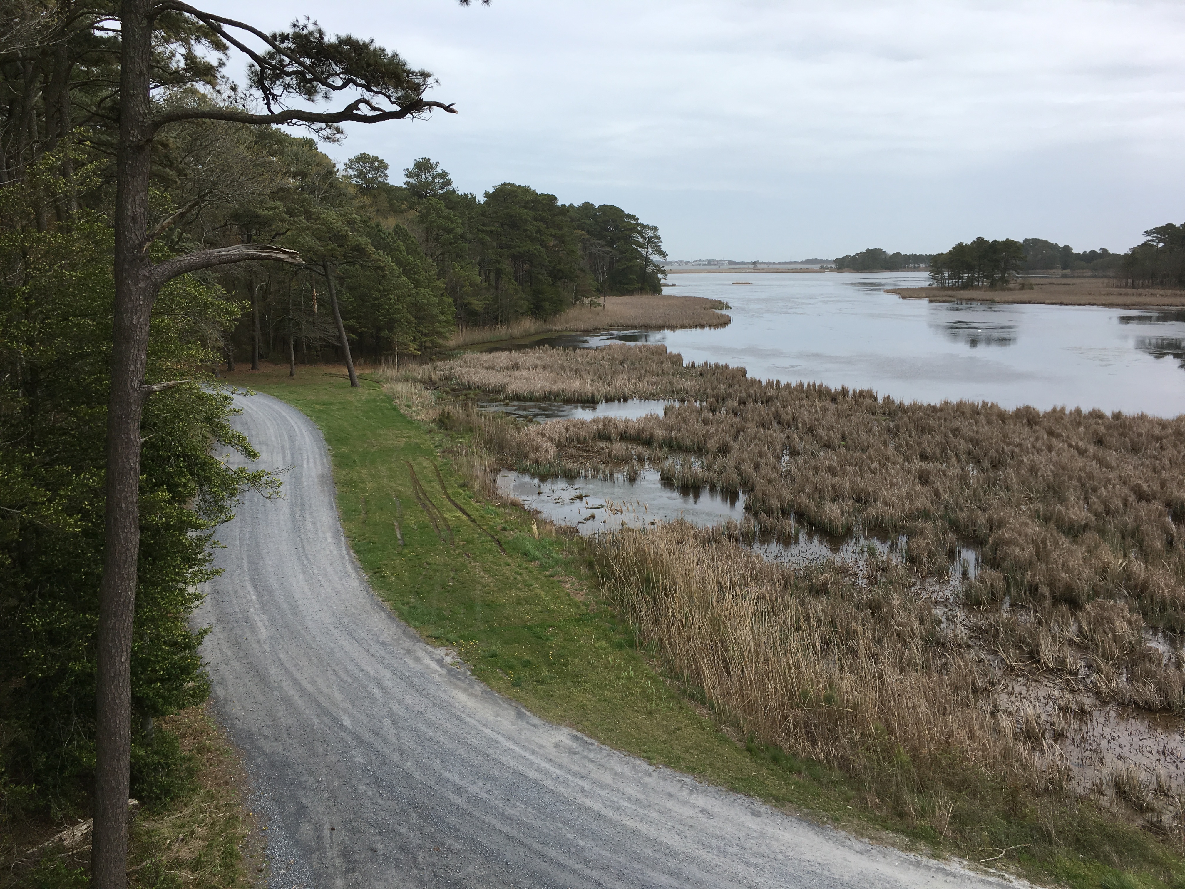
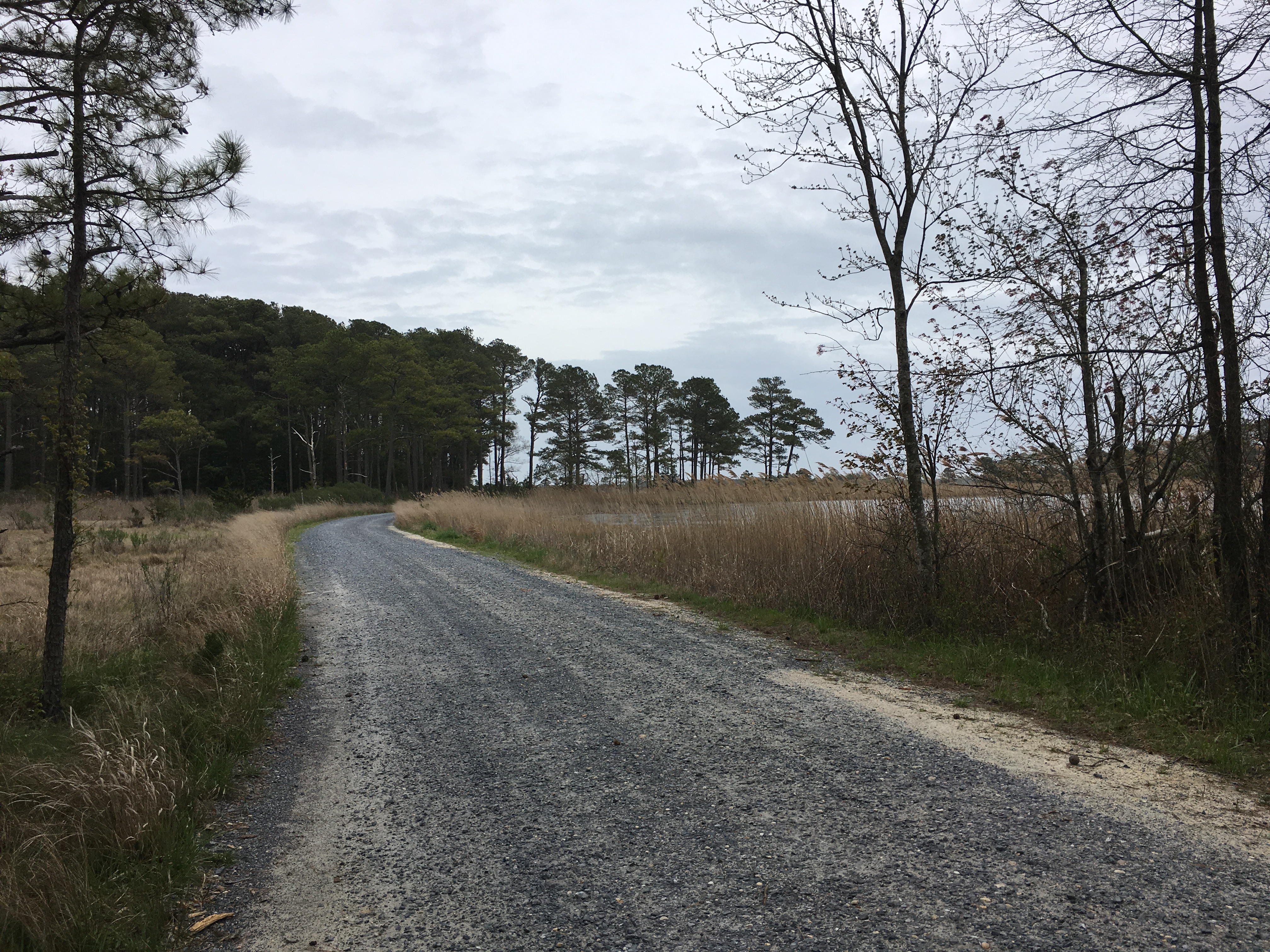
I wasn’t sure where to start and initially had driven into the refuge before deciding to park near a kiosk at the entrance. There were gravel roads in the refuge, and I first headed toward Mulberry Landing. There was an observation tower that I climbed to see the view. I made it to the top, even though it was windy as I climbed higher, which was a little scary. I quickly took a couple photos and headed down, continuing toward the landing.
When I came to the end of the road, I came to a large body of water, which looks to be Dirickson Creek leading into the Little Assawoman Bay. There was also a pavilion-type building.

There were three landings in the part of the wildlife area that I visited — Mulberry Landing, Strawberry Landing and Sassafras Landing. (Here’s a map.) I made it to each of these during my run.
The road to Strawberry Landing had a sign relating to hunting, but I looked up the hours and the allowed time for hunting ended at 1 p.m., so I went to that section after that time. I’m glad I did, because that was one of the most beautiful parts of the run. At Strawberry Landing, there was a pier that went out into another large body of water: Miller Creek.

I was thinking about doing eight to 10 miles, and even though I wasn’t feeling my best, I decided to get my money’s worth and run 10. It wasn’t fast, and I stopped to take a lot of photos.
The distance meant that I repeated some of the gravel roads I’d run on. I was also using the run as a first test of my new Orange Mud Gear Vest Pro that I’m testing for BibRave, which I’ll be writing in more detail about in a future post.
On the way home, I stopped at Em-Ing’s, a barbecue place in Bishopville, Maryland, which I’d driven past numerous times but hadn’t stopped at. The food was good and also affordable.
I set a goal to travel to at least one new-to-me place for a run each month of 2019. Here are the other places I’ve traveled to for runs this year:
- March: Chapel Branch Nature Trail
- February: Mutton Hunk Fen Natural Area Preserve, Patuxent Research Refuge North Tract
- January: Mount Vernon Trail

What a pretty place to run. The process to get a pass does sound s bit complex though. Glad you were able to get out and enjoy it!
LikeLike
Looks like a peaceful place to run but definitely a steep cost for a one time visit. I love your goal to run in a new place each month! I look forward to seeing your next place.
LikeLiked by 1 person