I was determined to run somewhere new the weekend of Sept. 14-15. I was originally planning to make the trip to see my family starting on Friday so that I could run somewhere new Saturday morning. That didn’t work out, and then I also didn’t get up early enough to run anywhere new on Saturday.
But after a Ravens game and bringing my sister back to her apartment on Sunday, Sept. 16, I decided to run at the Red Run Stream Valley Trail in Owings Mills for the first time.
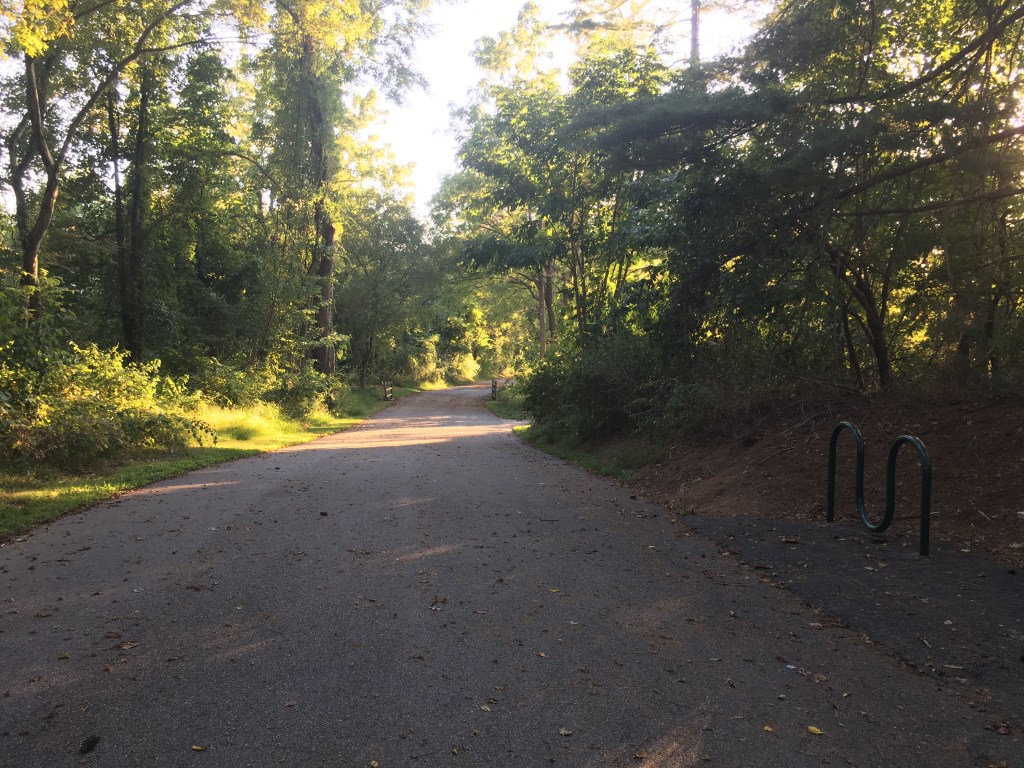
This trail is right off Route 795, on Red Run Boulevard in Owings Mills, Maryland. There is a small parking lot with 10 spots (one of which is a handicapped spot), and I got the last spot when I got there on a Sunday evening. I passed the parking lot the first time, so be alert.

I thought the trail would be a little longer based on the first Google result I saw, but this link seems to have the distance as more accurate, at 1.2 miles. I put down in the notes on my phone that the paved part of the trail was about 1.1 miles.
Once I parked, I followed the paved trail and went on a short paved loop for a total of about .25 miles before I came to a sign for an unpaved part of the trail that was .75 miles. I decided to take that and ran on the Red Run Stream Valley Trail unpaved spur, which went to Lakeside Boulevard. After reaching the end of that trail, I turned back around and ran the .75 miles back to the paved trail.
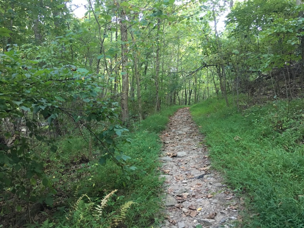
On my way toward Lakeside Boulevard, I saw a deer, and if I’m remembering correctly, I saw two.
I turned left at the end of this spur to continue onto the paved trail. There was another short loop, and then, the trail became more narrow — but it was still paved. I followed this until the paved trail ended and a wooded trail began. I ran on that for a tiny bit. Although I turned around soon after getting into the wooded area, this connects to Soldiers Delight, where I ran back in 2015.

Then, I ran back straight on the paved trail, not taking the super short loops, which is when I ended up with about 1.1 miles for that stretch. I was at around 4.5 or so miles when I made it back to the car, so I decided to run up and back on Red Run Boulevard to end with a total of five miles.
There were some hills. Elevation has been off on my watch for a while, but with the elevation corrections on Garmin Connect, I logged about 237 feet of elevation gain during this run.

I set a goal to travel to at least one new-to-me place for a run each month of 2019. Here are the other places I’ve traveled to for runs this year:
- August: New Smyrna Beach, Florida
- July: Tuckahoe State Park, Delaware & Raritan Canal State Park and Delaware Canal State Park trails
- June: Oregon Ridge Park, John Heinz National Wildlife Refuge at Tinicum, Benjamin Franklin Bridge
- May: Powellville, including Adkins Mill Park
- April: Assawoman Wildlife Area
- March: Chapel Branch Nature Trail
- February: Mutton Hunk Fen Natural Area Preserve, Patuxent Research Refuge North Tract
- January: Mount Vernon Trail
Like She Runs by the Seashore on Facebook here.


3 thoughts on “2019 Running Travels: Stop off the highway at the Red Run Stream Valley Trail”
Comments are closed.