The day after the Crystal City Twilighter 5K, I wanted to run somewhere new while I was still out of town.

I had Googled interesting places to run by my grandparents’ house, and my grandmother suggested Lake Needwood, which was a short drive from their house. I decided to check it out, and there were plenty of trails to explore.
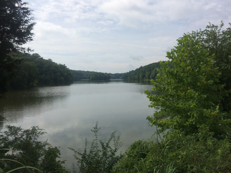
Lake Needwood is in Rock Creek Regional Park in Montgomery County (the address is in Redland, Maryland). Here’s a link to the trail map.
I wasn’t sure where exactly to park, but I figured I would be able to run around the lake. I found a kiosk by a foot bridge on Beach Road and decided to start there. After taking some self-timer photos of myself in my new Crystal City Twilighter 5K tank, I started my run, which would become sort of a run-hike with a lot of walking.

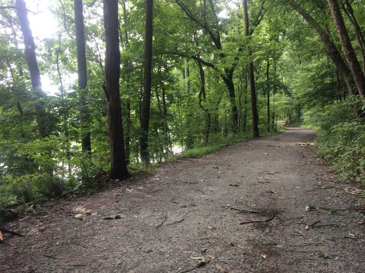
Just about immediately, there was a hill to go up. There were different places to turn off on the trails, but I tried to stick to what I figured was the main path. I hadn’t yet received the Under Armour Horizon RTT trail shoes that I’m testing for BibRave (a post will be coming on those), so I just wore my regular running shoes.
There were some extremely steep hills, and I found myself walking up them. One of the hills was listed on Strava as a 0.1-mile segment with an 81-foot, or 9.9 percent, incline. I believe this segment was a grassy hill I decided to go up.
If you decide to go to these trails and aren’t familiar with them, it might be a good idea to take a phone so you can refer to the map. Although I didn’t feel disoriented — the lake was an easy reminder of where you were — there were plenty of places to turn off. At one point, I decided to take a paved trail, which was another hill. It was actually a sidewalk, and it went out of the park. I decided to turn around and come back to the trails.

Some parts of the trail were single-track, some were much wider and some were grass. I made my way around the park and I wasn’t positive where I should leave the trail to head back to my car. It turned out that I could have just followed the trail back to my car, but instead, I turned off on the road and did the last part of the run on the road.
My Garmin logged 385 feet of elevation gain over the 4.5-mile run, and I sync my phone to Strava, which logged 329 feet somehow.
The Garmin seems to be more accurate with the elevation gain, because on my flat run today in Salisbury, Strava says I logged 161 feet of elevation gain, while Garmin has 39 feet.
On my Garmin stats, I haven’t broken 100 feet of elevation gain on a run since I did the run at Lake Needwood. All my runs have been in Salisbury, and the closest I got was 94 feet — that was for a 10-mile run.
It was definitely a different kind of workout. Another trail to check out next time I have some time to run in that area might be the Rock Creek Hiker-Biker Trail, which is paved. There is parking for that trail by Lake Needwood.
Like She Runs by the Seashore on Facebook here.

One thought on “Tackling the hills at Montgomery County’s Lake Needwood”
Comments are closed.