
At the beginning of the year, I set a goal to run six new-to-me places in the Washington, D.C., area, since I live in Salisbury but write for RunWashington.
Of course, that was before COVID-19. Since everything started getting canceled and shut down in mid-March, I’ve only even been on the other side of the Bay Bridge twice.
However, earlier this month, I made a trip up to Montgomery County to see family that I hadn’t seen since the winter holidays. We had a socially-distanced outside gathering (with no hugs), and afterward, I decided to check out the trails at Rachel Carson Conservation Park, about 15 minutes away from my grandparents’ house.

The park has a Brookeville address and is on the zip code line between Brookeville and Gaithersburg, but it’s really closest to the small communities of Unity, which I’d never heard of, and Sunshine, which I’d driven through countless times on my way to my grandparents’ house.
I’ve mostly been staying close to Salisbury since COVID-19 became an issue, and I was also thinking some areas in the Washington, D.C., metro area might be crowded, just because of the large population. However, there were only a few cars at Rachel Carson Conservation Park on Friday, July 3, and I only came across a handful of people — and a couple of their dogs. This park is in a more rural area of the county.
I figured I’d try to take a route that let me see as many trails as possible. From the parking area, I first went up a grassy hill on the Fox Meadow Loop Trail and continued onto the Rachel Carson Greenway Trail, which was in the woods.
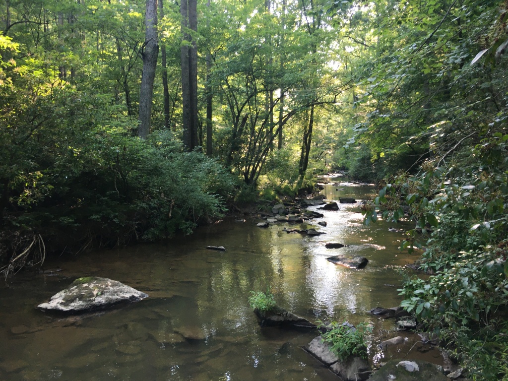
It wasn’t an extremely hilly trail, but coming from the Eastern Shore, I definitely noticed an incline, and then a descent. I turned onto the River Otter Trail and crossed the Hawlings River on some rocks. I continued a little bit on the other side of the river, but that area seemed pretty overgrown and I didn’t want to worry about ticks, so I turned around and headed back across the river and back onto the Rachel Carson Greenway Trail.

Along the river, I saw a couple people relaxing in hammocks, which I thought was awesome. I think they were reading; it definitely looked like a peaceful spot.
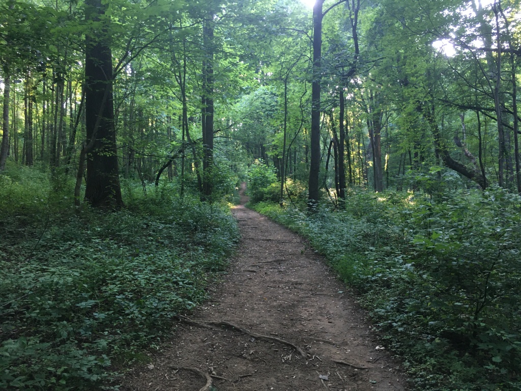
There were plenty of signs marking the different trails, and I kept following the Rachel Carson Greenway Trail even once I saw the sign for the Fern Valley Trail. This took me all the way to Route 97, where I turned around. This part of the trail doesn’t appear to be on the park map, and it was overgrown. Aside from this spur and the River Otter Trail, the other trails I ran were well-cleared.
The trails had roots to watch out for and some elevation change, and they were wider than singletrack trails.
After heading back on that spur, I followed the Fern Valley Trail and continued on that until I reached the Hidden Pond Trail.
I saw the hidden pond and then kept running until I came back to the grassy Fox Meadow Loop Trail, which I took the other direction until I ended up back at my car. I’d run 4.65 leisurely miles, including walking and picture-taking.
This was a beautiful place to explore, and the Montgomery Parks website says there are more than six miles of trails at the park. Do watch out for horse poop, as I did see that on the trails.
I didn’t get to quite all the trails, so if I go back, there will be more new routes to explore. The trail map can be found here.

While looking up this park, I noticed that it was right next to Elder Pine Brewing & Blending Co., where I bought a couple four-packs of beer post-run to take home. It seems to be a brewery hot spot: Waredaca is about a mile away, I passed Lone Oak Farm on the drive there, and Brookeville Beer Farm is also nearby.


Just finished reading the second book in Rachel Carson’s Sea Trilogy and love that there is a conservation park with her name associated with it. Such a wonderful role model, and the hammocks with people reading, priceless, what a gift!
LikeLiked by 1 person
Such a beautiful write-up. I am a travel blogger from India. Please give my blog a read too.
LikeLike