I’d been wanting to run at Patapsco Valley State Park in central Maryland ever since I learned of the park, when some friends did the Patapsco Valley 50K many years ago. I tried to run there several years ago after a meeting in Columbia and the parking area I went to was full, and I needed to get home before traffic, and I missed out. When I went to a meeting in Elkridge in late February, it looked like my perfect opportunity to run at Patapsco Valley State Park — and it finally worked out.
I got recommendations from friends in the 11:30 Club, who suggested the Cascade Trail and the Ridge Trail, also mentioning a paved trail on the other side of the river. It was a beautiful day, and I was up for a longer run, so I parked in a larger parking lot and started out on the Ridge Trail, heading toward the Cascade Trail. There was a $2 entry fee; well worth it for a beautiful run in nature.
Patapsco Valley State Park is a large park, and the area I went to is the Avalon/Orange Grove/Glen Artney Area.
There were some helpful markings and signs, but especially on the Cascade Trail, it was helpful to have this digital AllTrails map that Nate had provided, as there were lots of potential side trails to take.
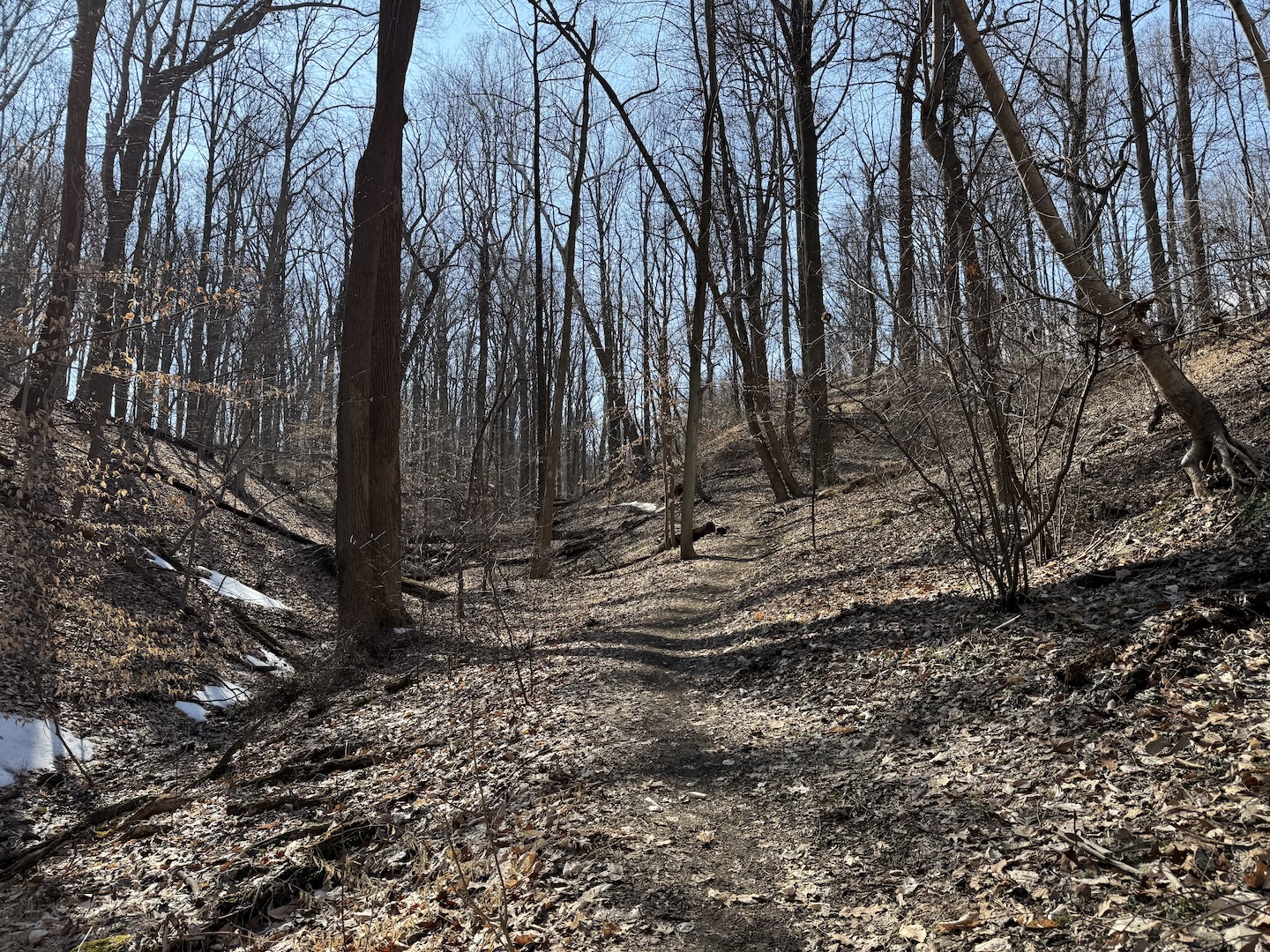
Right by the parking lot where I parked, there were bathrooms, and there was also a playground nearby for anyone who may be bringing the family out. I wasn’t really sure how long the Ridge Trail would end up being, but it was over three miles until I made it to the Cascade Trail, which I still wanted to run. It looked like these trails connected, but somehow, I made it out onto the road for a short stretch between them.
I ended up walking a decent amount, as there were both a lot of elevation and a lot of slippery mud. I didn’t want to fall down a hill with the mud, so I went slow. I was also exploring and taking photos and videos.
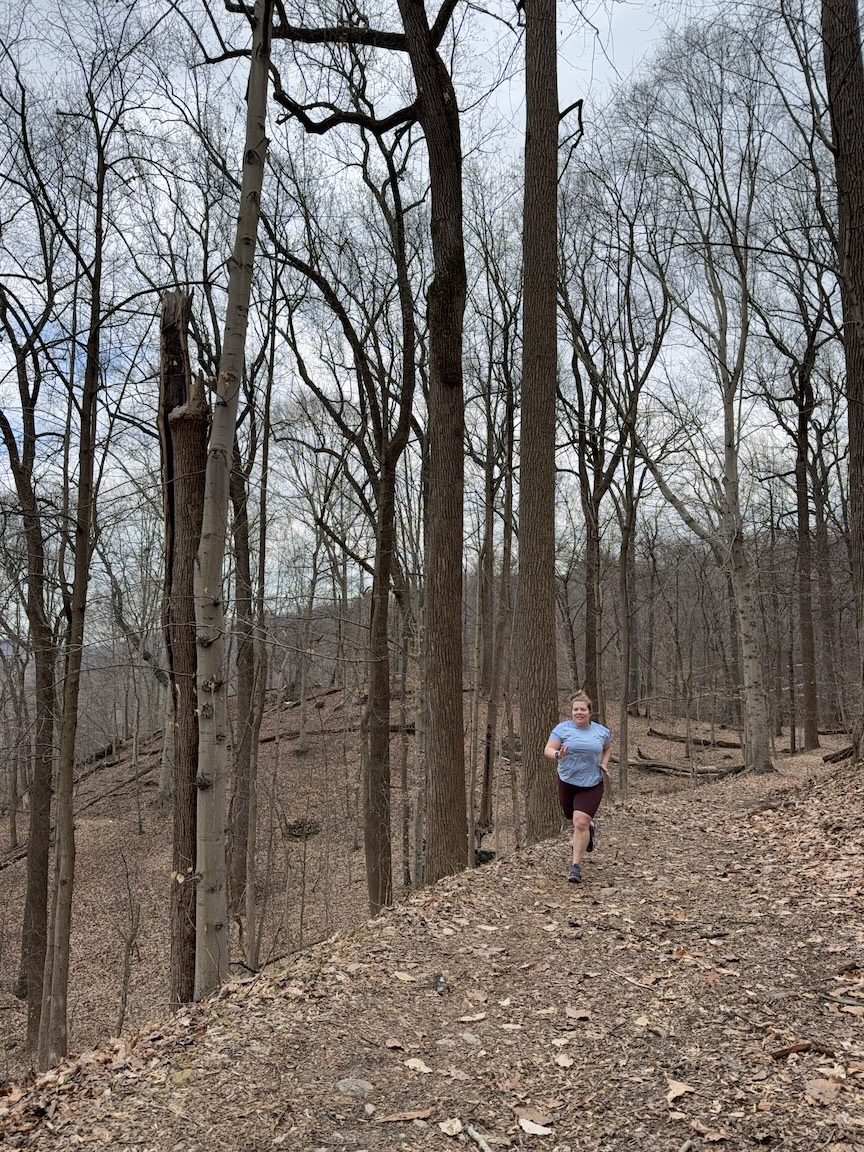
I live in a flat area, and these trails were certainly hilly for me. I ran a total of 8.65 miles, logging 1,174 feet of elevation gain on my watch. It took just over two-and-a-half hours, a 17:40/mile pace. The Strava segment I logged with the largest incline was “Ridge Trail Ext. Climb,” a 0.2-mile segment with 188 feet of gain, a 13 percent grade. Even a segment called “Ridge Flat” had a 2.8 percent grade. There were some downhill stretches, including two segments with about a negative 5 percent grade.
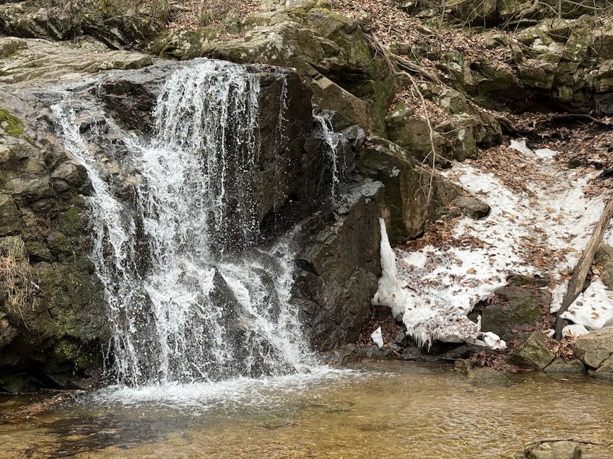
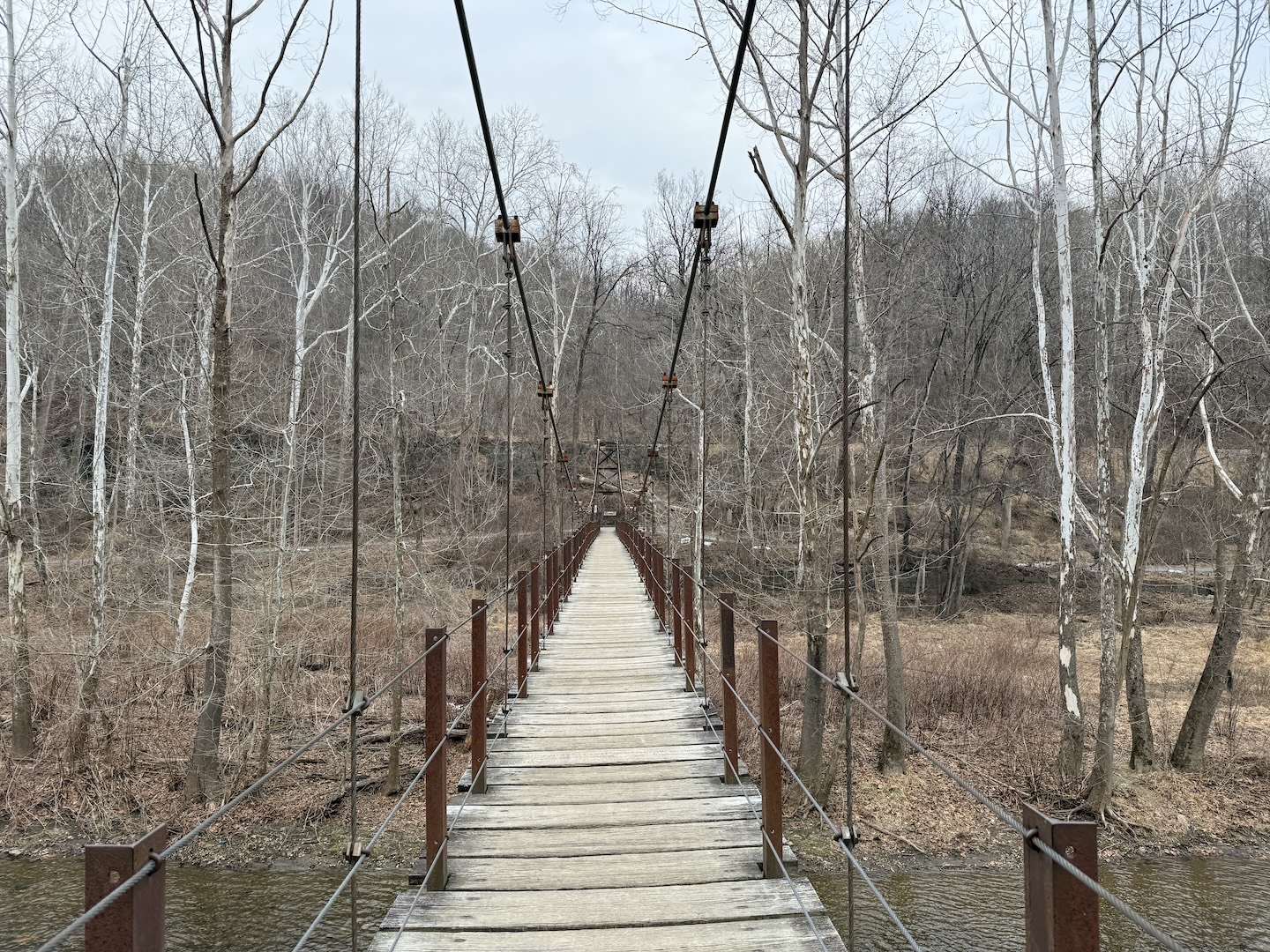
Some of the trails were singletrack, while other parts were wider. When I made it to the Cascade Trail trailhead, there was a bathroom and another parking area. I soon reached Cascade Falls and made my way up a rocky section, then taking a loop. When I finished that, I crossed the swinging bridge across the Patapsco River to the paved Grist Mill Trail, which led to a short mountain bike trail, before I went on a small road section to make it back to my car.
The paved, flat trail was a nice reprieve after lots of climbing and muddy conditions.
With over 200 miles of trails (70 of those miles maintained), according to the park’s website, I’m sure I could explore this park on numerous occasions and keep seeing new things, so I’ll definitely have to go back!
The address for the part of the park I visited is 5120 South St, Halethorpe, MD 21227. It’s also really close to Baltimore/Washington International Thurgood Marshall Airport.